Utilities
A suite of utilities has been developed for DUSTRAN that automates certain data collection and assimilation processes. The datasets generated by these utilities can be used directly within the DUSTRAN interface and are intended to greatly extend the functionality of the modeling system while minimizing site-specific data-input requirements. Currently, three utilities--Add-Site Wizard, Layer Creator, and MetArchiver--are available. An overview of each utility is presented in this section; a detailed description of each utility is available in the DUSTRAN User Manual.
- Add-Site Wizard
-
A new site can be added to DUSTRAN using the "Add Site" wizard within the DUSTRAN interface. A new site contains all the geophysical data, such as terrain and land use/land cover, that is needed to run the AERMOD, CALPUFF, and CALGRID dispersion models. In addition, a new site contains base geospatial data that are used for displaying and analyzing the site within MapWindow. After a new site has been created, the user can add additional geospatial data to customize the map for a particular scenario or application. The Add-Site wizard effortlessly guides the user through a series of easy-to-use forms to automate the following tasks:

Example of the Add-Site Wizard clipping ArcMap layers for use in a DUSTRAY simulation site (click image to enlarge).- Specify the spatial range, or extent, of the new site.
- Designate a name and UTM zone for the site.
- Create a new site directory that contains all the necessary template files for performing a simulation in DUSTRAN.
- Build DUSTRAN's meteorological surface (.snf) and upper-air (.unf) station information files.
- Build and save new GIS map files for display in MapWindow.
- Register the site so that it can be opened within the DUSTRAN interface.
- Layer Creator
-
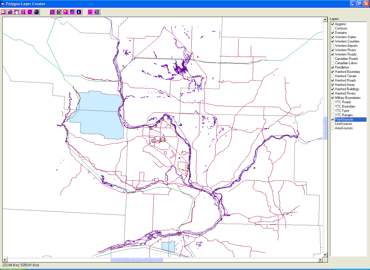
The Polygon Layer Creator is a software application that can be used to create polygon-based GIS data for use in a DUSTRAN scenario. Using the .mwprj project file for a DUSTRAN site, a user can draw areas onto the map of the site and assign characteristic codes to each of the polygon areas through simple point-and-click operations. Once new areas have been drawn or existing areas have been modified, the utility can be used to generate a new shape file containing the changes as well as a .csv file. The text file can be used directly by the DUSTRAN modeling system for retrieving certain land-based characteristics, such as soil textures and vegetation classes, for use in wind-blown dust simulations. The interface for the Polygon Layer Creator consists of three parts: a map display, a table of contents for the layers displayed in the map, and a toolbar with buttons for use in controlling the map display and editing the polygons.

Example basemap file loaded into the Layer Creator utility (click image to enlarge).