USGS Lake Tahoe Data Clearinghouse U.S. Geological Survey Lake Tahoe Data Clearinghouse The National Map Geography Western Geographic Science Center

Maps of Lake Tahoe


This page contains miscellaneous maps from a variety of sources available across the internet. These maps are images rather than GIS ready data. For more information on maps and GIS data, please see the GIS Data Download page.

Click on the image for a larger version with more detail.
Click on the links to learn more about it.

Thumbnail of a road map.

Left: Map showing the available roads to get to Lake Tahoe.

Click here to download a forest service road map.

Right: Map of the 7.5-minute quads in Lake Tahoe Basin area.

Thumbnail of a map of the 7.5-minute quads.
Thumbnail of satellite image.

Left: footer image. Satellite images of the Tahoe region from the USGS.

Right: footer image. National Atlas Map of Lake Tahoe.

Thumbnail of a National Atlas map.
Thumbnail of a slope map.

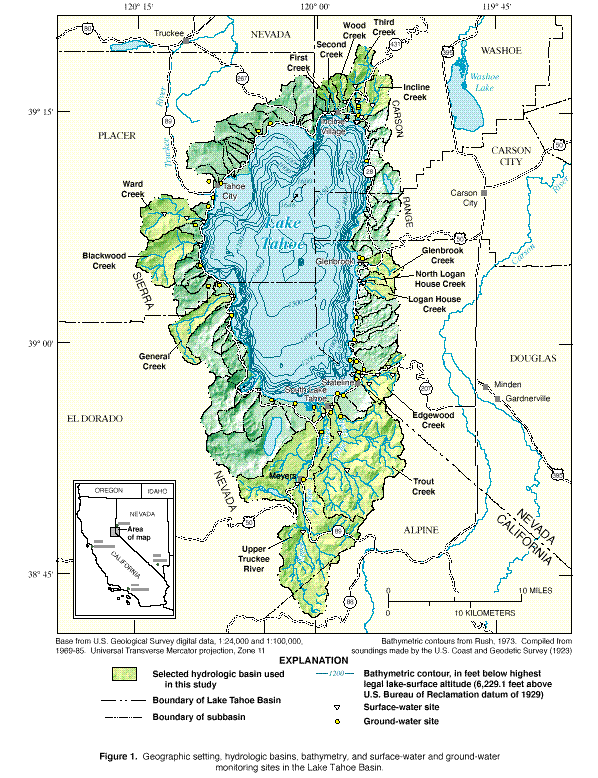
Left: A map of slope in the Tahoe Basin.

Right: Lake Tahoe with bathymetry and monitoring sites, acquired from footer image. Stream and Ground-Water Monitoring Program.

Thumbnail of a map of monitoring sites.

Welcome

Digital Data

General


footer image Links open in a new window. Skip footer notes.
Horizontal Blue Bar.
U.S. Department of the Interior || U.S. Geological Survey || National Mapping Information || Western Regional Geography
Home Page. First Gov, your first click to the US Government. URL: http://tahoe.usgs.gov/maps.html
Page Contact: M.Gould, mgould@usgs.gov
Last Modified: Thursday, 13-Dec-2012 16:09:18 EST (tm)
Privacy Statement || Disclaimer || FOIA || Accessibility || Web Team || Feedback || Search